
Ru K’ux Abya Yala
Supporting el buen vivir as a model of Indigenous life.
About
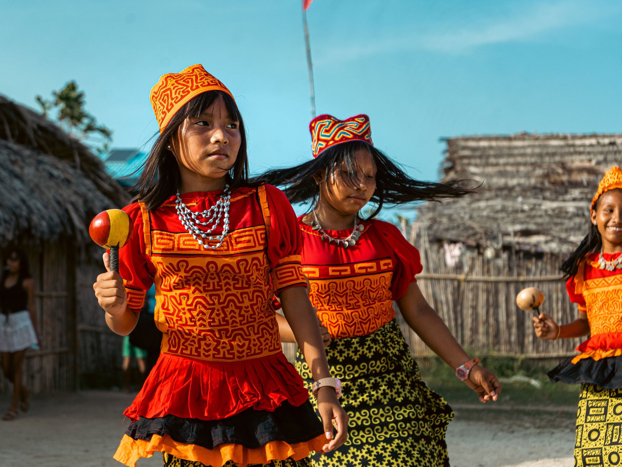
In Mesoamerica, a consortium of Indigenous organizations led by Sotz’il is working to foster the Indigenous use, management, and conservation of natural resources in the regions of the Ru K’ux Abya Yala and to promote the Utz K’aslemal (el buen vivir – living in harmony) as a model of Indigenous life.
Working in an area composed by three biocultural territories (Kaqchikel and K’iche’ Volcanic Chain, Lachuá and Caribbean Rainforests of Guatemala, and Guna of Panama) and spanning more than 56,000 hectares of land stretching from Guatemala to Panama, through ICI Sotz’il is strengthening Indigenous institutional systems, promoting intergenerational exchanges and gender equality, bolstering Indigenous-led natural and cultural resource management in the context of the COVID-19 recovery, and promoting Indigenous green economy for the benefit of all.
Under this initiative, ICI supports the restoration of 150 hectares of degraded agricultural lands, the improved management of 103,585 hectares of landscapes, and 435,068 hectares of fisheries meeting biodiversity certification standards, while engaging 9,860 direct project stakeholders.

Led by
Sotz’il
Key ICI achievements in the Ru K’ux Abya Yala
-
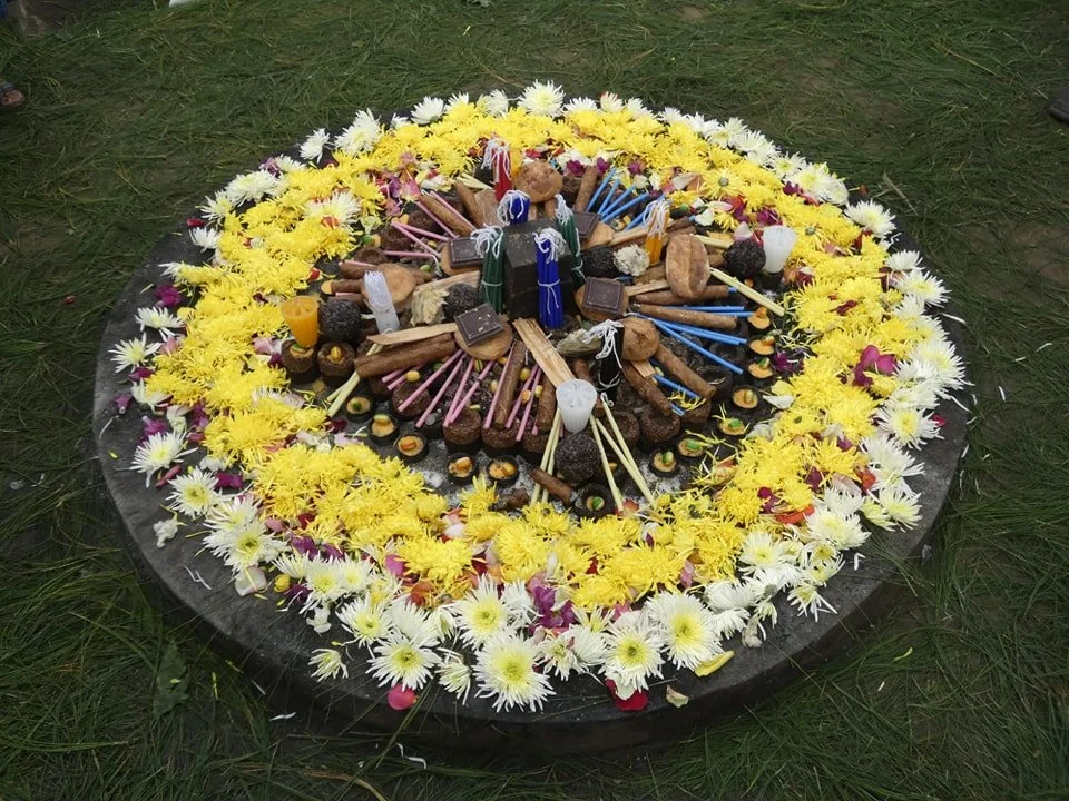
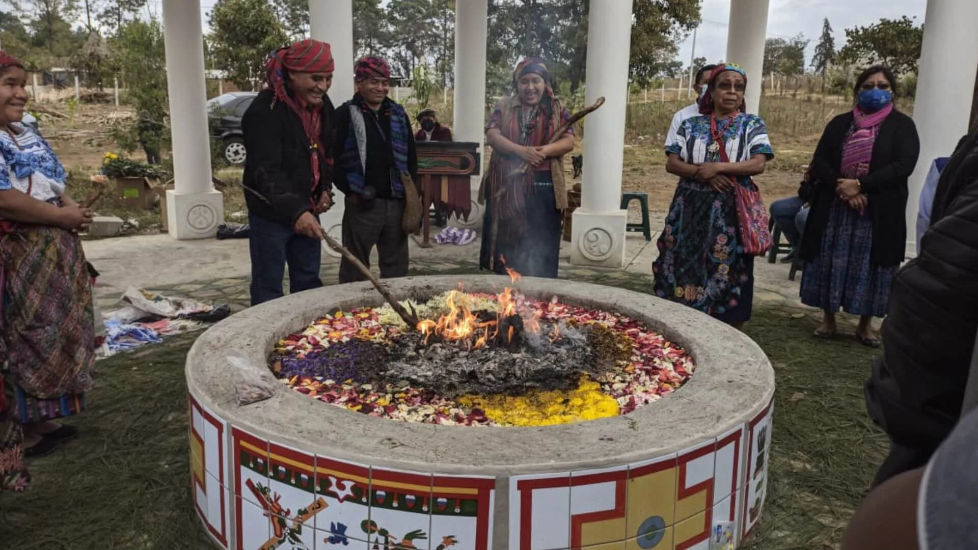
![A circular arrangement of sweets and chocolates on a bed of flower petals, chalks, and colored sticks, surrounded by yellow and white flowers on grass as a part of an Indigenous Maya ceremony.]()
330+ Indigenous leaders, women, and youth
trained on community governance, collective forest management, natural resource conservation, collective rights, conflict resolution, and intergenerational transmission of traditional knowledge.
-
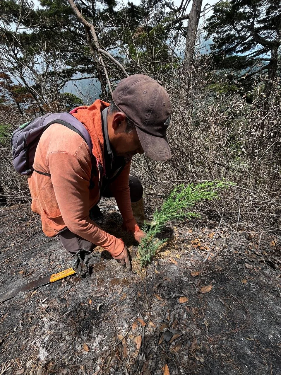
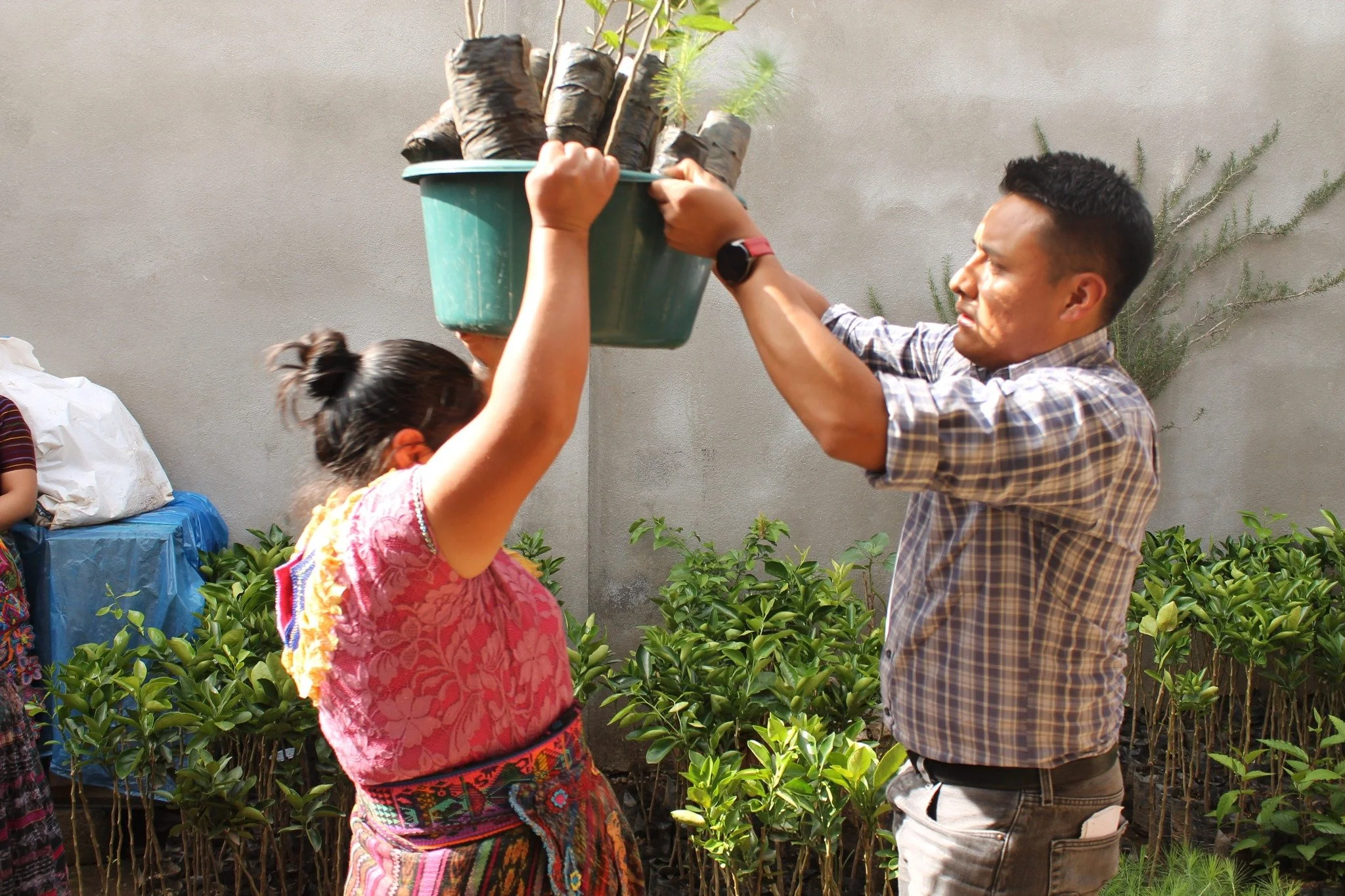
![An Indigenous man is helping a woman plant a small tree in a pot outdoors, with green plants and a gray wall in the background in Guatemala.]()
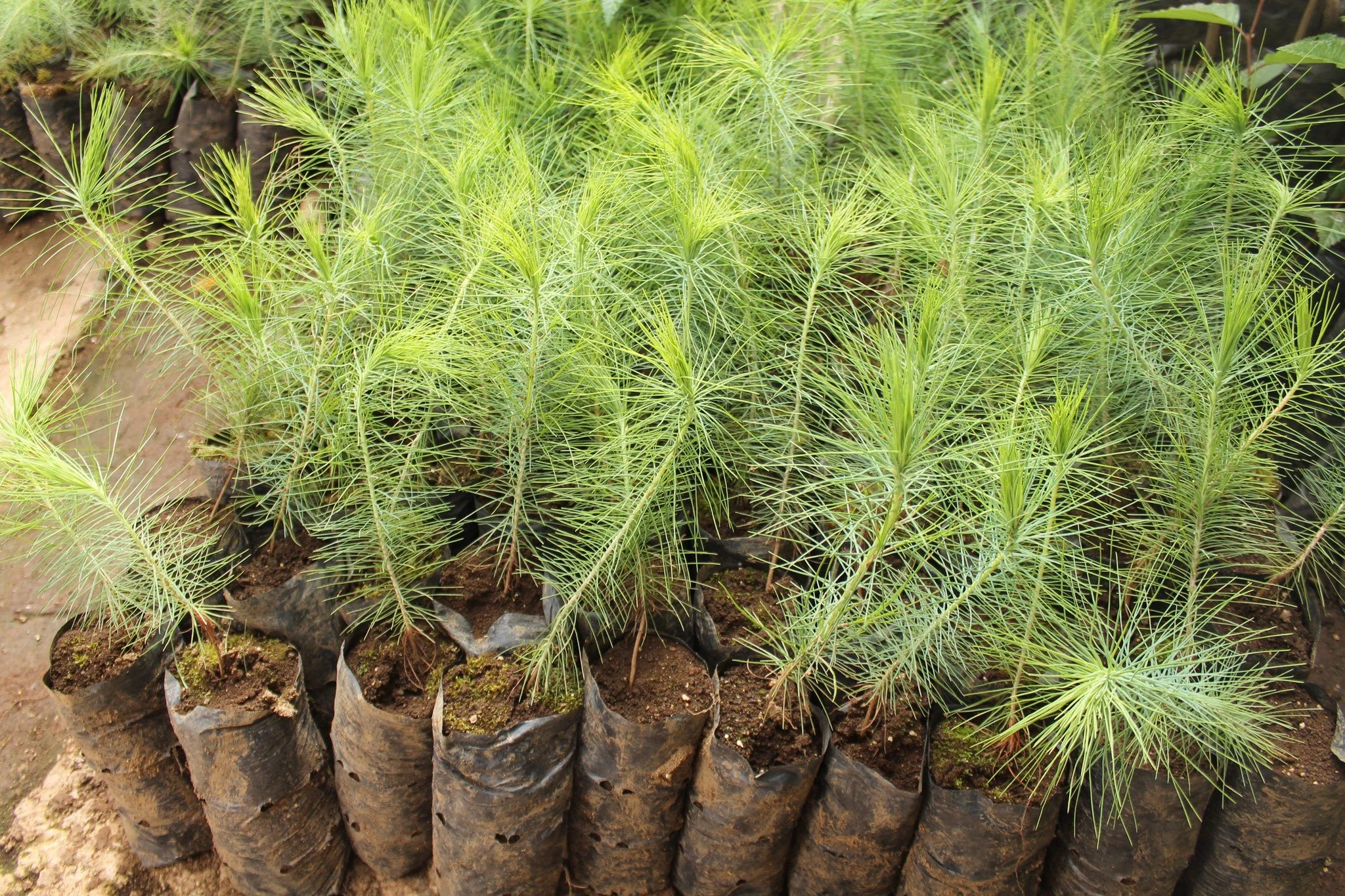
28,000+ plants distributed and 15,000 grafted cacao seedlings
procured for new agroforestry system
-
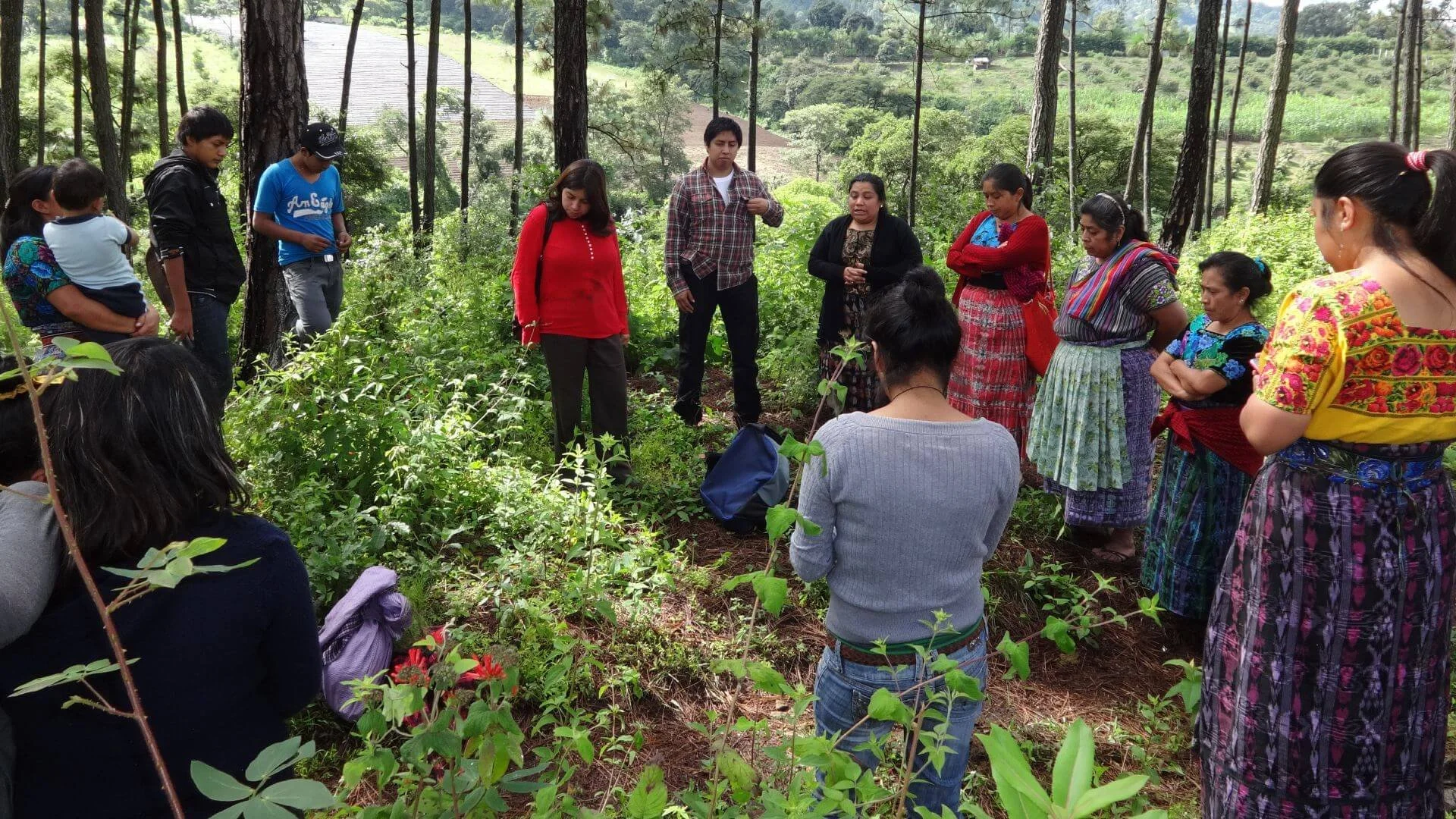
![Group of people gathered outdoors in a forest, listening to a woman speaker in the center. The group includes men and women, some wearing traditional clothing, standing and sitting among trees and greenery in Guatemala.]()
USDA organic certification achieved
47 youth trained in cacao-based agroforestry and cultural knowledge.
-
![]()
1,659 direct stakeholders reached cumulatively
with 60 new project stakeholders in Chisec, Cobán, and Ixcán.
-
![]()
225 Indigenous youth (120 men, 105 women)
engaged in intergenerational learning through youth-led reforestation and restoration actions.
Explore Related News from the Sotz’il led consortium
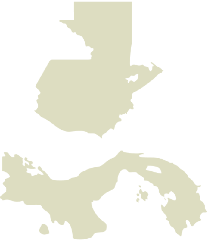
The Region
Guatemala and Panama
Approximate area in hectares:
5,486,800
Indigenous Maya; Garifuna; Guna population:
7,670,887
About the Ru K’ux Abya Yala Indigenous territories
The Central American region has 8% of the world’s biological diversity, distributed in 206 ecosystems, 33 ecoregions, 20 life zones and 12% of the coasts of Latin America and the Caribbean, including 567,000 ha of mangroves and 1,600 km of coral reefs.
This ICI subproject has a regional focus for an integrated intervention in Mesoamerica, which works in Indigenous territories in two countries – Guatemala and Panama – in landscapes that form important ecoregions in Central America, including the Mesoamerican Biological Corridor, the Ecoregion of Montane Forests, the Association of Pine-Oak Forests of Central America and the Mesoamerican Reef System.
These ecosystems are interconnected for the purpose of conserving ecological processes, facilitating genetic exchange, evolution, migration, and repopulation of species and are consistent with Indigenous Maya, Garifuna, and Guna territories. The Kaqchikel Volcanic Chain and K’iche’ are part of the broadleaf, cloud, pine and oak forests and grasslands that are part of the Zunil, Atitlán and Balam Juyu Biocultural Corridor, which are rich in endemic faunal biodiversity. Lachuá, Q’eqchi territory, is an ecoregion of broadleaf forests and a Ramsar site, of 100,000 hectares. It links to the Blue Mountains of Chiapas Mexico, is the second model forest of Guatemala and is part of the Ibero-American model forest network. It represents more than 50% of Guatemala’s biodiversity, the majority of which are endangered species. The Río Dulce region has biological connectivity and is home to species of regional endemic importance. The Guna Yala region covers 751,300 hectares of continental and marine areas. It is a high priority ecoregion for the conservation of global diversity and functions as a biocultural corridor in the Isthmus, with about 70% forest coverage, 30 species of reptiles, 440 species of birds, and other tropical forest species. It also has coral reefs, mangrove ecosystems, extensive networks of reefs and shallow water seagrass beds of the continental platform, of importance in the biographical coast of the Northwest Atlantic and the central Caribbean bioregion.
The areas in this subproject are under different modalities of use, management and conservation of natural resources. In the case of the Mayan (Kaqchikel, K’iche’, Q’eqchi’) and Garifuna peoples they are under a system of collective Indigenous management and shared management. The Guna case involves management by an Indigenous system led by regional congresses. Central America has 948 terrestrial and marine protected areas, with an extension of 245,857 km2, of which approximately 39% is located in Indigenous territories, such as the Mayan forest, parks in municipal regions, Guna Yala biosphere reserve, resulting in a shared management and governance between protected area systems and indigenous territories. Indigenous governance in each region is based on their own traditional forms of organization and governance, local committees, ancestral brotherhoods, organization of spiritual guides, Indigenous community, territorial councils, development councils or county congresses.
Percentage of the country’s land area under recognized IP or LC ownership:
Guatemala 16%
Panama 22%
(Source: RRI: 2015. Who Owns the World’s Land?)
Number of Land Defenders Killed 2016-2018:
Guatemala 25
Panama 0
(Source: Global Witness)
Biodiversity Significance
Local Context
-
Agriculture
Agroforestry
Non-timber Forest Products (NTFPs)
Tourism
Fishing
Hunting
Payment for ecosystems services
-
Agricultural expansion and commercialization
Climate change
Deforestation, overgrazing, and overexploitation of wildlife and other natural resources
National and Regional Policies and Plans linked to tenure security
Loss of indigenous knowledge
Mining
Infrastructure development (e.g. roads, railways, pipelines, transmission lines, wind farms, geothermal projects, airports, dams)
Illegal logging
Hydrocarbon Activity
Solid waste contamination of ocean, marine invasive species